Together, we solve the challenges of tomorrow.
LEARN MORE →Geotechnical investigation in Abbotsford forms the essential first step in any construction or civil engineering project, providing critical data about the subsurface conditions that will directly influence foundation design, earthworks, and long-term structural performance. This category encompasses a suite of in-situ testing methods and sampling techniques designed to characterize soil stratigraphy, strength parameters, compressibility, and groundwater conditions. In a region as geologically diverse as the Fraser Valley, understanding what lies beneath the surface is not merely a regulatory checkbox but a fundamental engineering necessity that mitigates risk and prevents costly failures.
Abbotsford's geology presents unique challenges that make thorough site investigation indispensable. The city rests on a complex tapestry of glacial and post-glacial deposits, including thick sequences of Sumas till, glaciomarine silts and clays, and alluvial sands and gravels associated with the Fraser River and Sumas River systems. Much of the low-lying terrain, particularly in the Sumas Prairie area, is underlain by compressible organic soils and peat layers that can undergo significant long-term settlement. Additionally, the region is classified within a high seismic hazard zone (Seismic Category 4 under the National Building Code of Canada), where liquefaction potential in loose, saturated sandy deposits must be rigorously evaluated. The Abbotsford Aquifer, a vital municipal water source, also demands careful assessment to ensure construction activities do not compromise groundwater quality or quantity.
All geotechnical work in British Columbia must conform to the BC Building Code, which references the National Building Code of Canada (NBC) and CSA standards. Engineers rely on CSA A23.3 for concrete design, CSA S6 for bridge and highway structures, and the Canadian Foundation Engineering Manual for accepted practice. Site investigations are typically scoped to meet the requirements of a Level 3 or Level 4 geotechnical investigation as defined by Engineers and Geoscientists BC (EGBC) guidelines. These professional practice guidelines mandate that investigations be supervised by a qualified professional and that the resulting reports address ultimate and serviceability limit states, including bearing capacity, settlement, slope stability, and seismic response. For the City of Abbotsford specifically, development permit applications must include a geotechnical report stamped by a professional engineer licensed in BC.
The scope of an investigation is tailored to the project type. Low-rise residential buildings might require a combination of exploratory test pits to visually log shallow soils and collect disturbed samples, providing a cost-effective view of the upper stratigraphy. For mid-rise commercial structures where deeper bearing layers must be proven, SPT drilling is the standard, delivering both a continuous soil profile and N-value data for empirical foundation design. In areas with thick, soft clay or silt deposits, such as those found across the Abbotsford lowlands, CPT testing offers a near-continuous profile of tip resistance and sleeve friction, allowing for precise delineation of soil layers and direct assessment of undrained shear strength and consolidation characteristics without the disturbance inherent in drilling. Large infrastructure projects, bridges, and industrial facilities will often deploy all three methods in a phased approach to build a comprehensive geotechnical model. Ultimately, a well-executed investigation in Abbotsford translates directly to safer, more efficient, and insurable construction.
The City of Abbotsford typically requires a geotechnical investigation for any development that involves new foundations, significant grading, or construction near slopes and watercourses. This applies to building permit applications for residential, commercial, and industrial projects. The requirement ensures compliance with the BC Building Code and local bylaws, particularly to address the region's seismic hazards, variable soil conditions, and sensitive aquifer protection zones.
Abbotsford's subsurface is dominated by glacial deposits, including dense Sumas till, but also contains significant pockets of soft, compressible glaciomarine clay and organic peat, especially in the Sumas Prairie. These soft soils can lead to excessive settlement if not properly identified. Additionally, the high seismic hazard classification means loose granular soils must be checked for liquefaction potential, a phenomenon where soil temporarily loses strength during an earthquake.
The investigation depth depends entirely on the structure and soil profile, but a common rule is to explore to a depth where the added stress from the foundation is less than 10% of the existing overburden pressure. In practice, for a typical low-rise building in Abbotsford, borings or CPT soundings often extend 10 to 20 metres below grade. If deep compressible layers or pile foundations are anticipated, depths can exceed 30 metres to reach competent bearing strata.
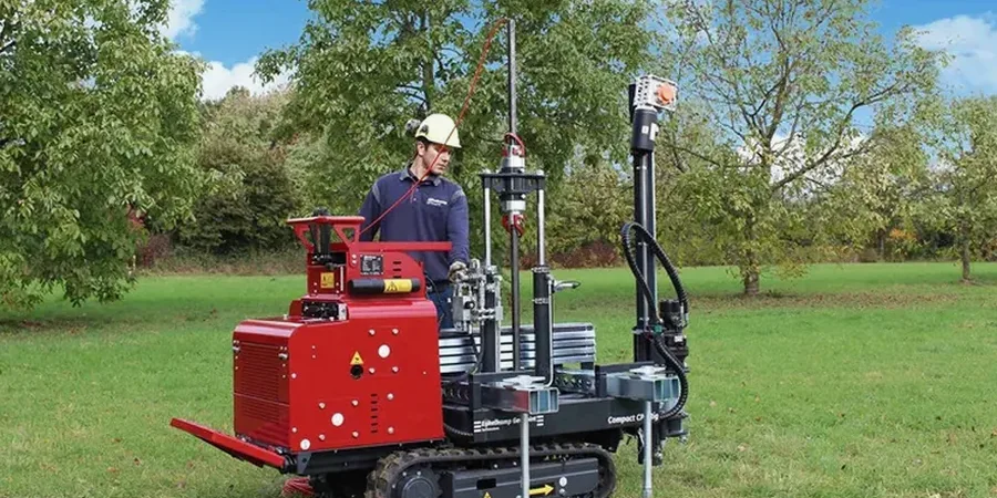
A test pit involves excavating a trench to visually inspect shallow soils, typically limited to 4 metres depth. SPT drilling uses a split-spoon sampler driven by a hammer to collect disturbed soil samples and measure penetration resistance (N-value) at intervals, providing both a sample and an index strength. CPT testing pushes an instrumented cone into the ground continuously, measuring tip resistance and sleeve friction without sampling, yielding a highly detailed, near-continuous profile of soil behaviour, ideal for soft clay and liquefaction assessment.