← Home · Underground Excavations

Geotechnical Excavation Monitoring in Abbotsford, BC

Together, we solve the challenges of tomorrow.

LEARN MORE →

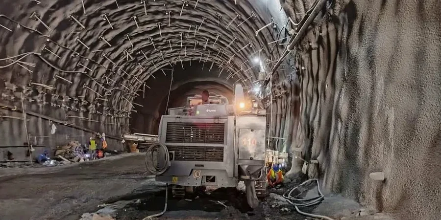
Abbotsford sits on a complex mix of Sumas Drift and Advance glacial deposits, where stiff clay tills can transition into loose outwash sand within a single cut. That variability, combined with a water table that often sits just 3 to 5 meters below grade across the Matsqui Prairie, makes unmonitored excavation a direct gamble. Our team deploys automated inclinometers, vibrating wire piezometers, and robotic total stations to track shoring deflection and pore pressure in real time. For deep excavations near the Sumas fault zone, we pair monitoring with a seismic refraction survey to map bedrock depth before the first bucket hits the ground, because the difference between till and weathered mudstone changes the entire support design.

Real-time deflection data turns a shoring design from a static calculation into a living safety system that adapts to what the ground actually does.

Process and scope

Abbotsford's wet winters and rapid spring melt create pore pressure spikes that can destabilize even a well-designed shoring wall in under 48 hours. We configure monitoring arrays to capture both the seasonal high in February and the rapid drawdown in April, when the risk of basal heave increases sharply. Readings from standpipe and VW piezometers are correlated with inclinometer deflection curves to distinguish between creep and active movement. On sites where excavation cuts through the Fort Langley formation's interbedded silts, we often recommend combining monitoring with in-situ permeability testing to calibrate dewatering rates and prevent piping at the toe. Every data point feeds a cloud dashboard that the superintendent and geotechnical engineer review on the same shift, with automated SMS alerts set at 80% of the design threshold. Our lab operates under ISO 17025 for sensor calibration, and all optical survey runs close on control points tied to the city's geodetic monument network.
Geotechnical Excavation Monitoring in Abbotsford, BC
Technical reference image — Abbotsford

Local ground factors

In Abbotsford, we have seen excavations where a 15 mm inclinometer deflection in till was stable for three weeks and then accelerated overnight when a watermain leak saturated the backfill. That kind of non-linear behavior is what monitoring catches before it becomes a rescue operation. The biggest threat is not the soil itself, it is the assumption that glacial till behaves uniformly. A single lens of glaciofluvial sand trapped behind a soldier pile wall can drain the groundwater table from a block away, triggering settlement under an adjacent structure. Monitoring without piezometers is blind to that risk. We also track vibration from compaction equipment near the crest, because a Cat 815F sheepsfoot roller within 4 meters of the edge can induce lateral stress that a static design never anticipated.

Need a geotechnical assessment?

Reply within 24h.

Email: contact@geotechnicalengineering.xyz

Reference parameters

ParameterTypical value
Monitoring frequency (active phase)Daily to continuous, event-triggered
Inclinometer casing depth3–5 m below deepest excavation level
Piezometer typeVibrating wire + standpipe backup
Optical survey accuracy±1.5 mm + 2 ppm, Leica TS16 total station
Alert threshold (typical)80% of design deflection or 0.5× design pore pressure
Reporting standardNBCC 2020 Part 4, CSA A23.3 Annex S

Complementary services

01

Automated Real-Time Monitoring Package

Continuous inclinometer strings, VW piezometers with data loggers, and a robotic total station with prisms on shoring and adjacent structures. Data streams to a secure web dashboard with configurable SMS and email alerts. Ideal for excavations deeper than 4.5 m or within 15 m of occupied buildings.

02

Manual Survey & Reading Program

Scheduled weekly or event-driven monitoring using traversing inclinometer probes, standpipe piezometer readings, and optical survey runs. Suited for shallower cuts in competent till or projects with a longer construction window where real-time data is not required by the geotechnical engineer of record.

Regulatory framework

NBCC 2020 Part 4 – Structural Design, CSA A23.3:2019 – Design of Concrete Structures (Annex S – Shoring), ASTM D6230 – Standard Practice for Monitoring Earth or Structural Movement Using Inclinometers, ASTM D7299 – Standard Practice for Verifying Performance of Vertical Inclinometer Probes, CAN/CSA-S6-19 – Canadian Highway Bridge Design Code (excavation support)

Common questions

How much does geotechnical excavation monitoring cost for a typical Abbotsford project?

Monitoring programs in Abbotsford typically range from CA$1,000 to CA$3,140 per month depending on the number of instruments, reading frequency, and whether automated data loggers are required. A basic manual program with four inclinometer readings and two piezometer checks per month starts lower, while a fully automated system with robotic total station, cloud dashboard, and 24/7 alerting sits at the upper end.

What instrumentation do you install for a deep excavation in glacial till?

We install vertical inclinometer casings in boreholes behind the shoring wall, typically extending 3 to 5 meters below the subgrade elevation to capture any deep-seated movement. Vibrating wire piezometers are placed at the mid-height of the retained soil and at the base of the excavation to monitor pore pressure changes. Optical survey prisms are fixed to the walers, the adjacent street pavement, and any building within the zone of influence.

How quickly can you deploy a monitoring system after we start excavation?

Inclinometer casing and piezometers require boreholes drilled before or during the early excavation stages, ideally from the working grade before the cut reaches 3 meters. We can mobilize a drill rig and install instruments within 3 to 5 working days of receiving a notice to proceed. Optical survey prisms and baseline readings can be established in a single day once the shoring wall is in place.

Do you provide monitoring data that the City of Abbotsford building inspector will accept?

Yes. All reports are stamped by a professional engineer registered with Engineers and Geoscientists BC and reference the NBCC 2020 and CSA A23.3 standards. We present deflection versus time plots, pore pressure hydrographs, and cumulative displacement vectors in a format that municipal inspectors and the geotechnical engineer of record can review directly without reformatting.

Location and service area

We serve projects in Abbotsford and surrounding areas.

View larger map