The BC Building Code and CSA A23.3 set clear expectations for groundwater control, but in Abbotsford the rules get tested by geology. The city sits on a complex mix of Sumas Drift deposits, glaciomarine silts, and coarse Abbotsford Outwash—a legacy of the last glaciation that makes permeability wildly unpredictable. You can drill two boreholes fifty meters apart and get completely different responses. The Lefranc test gives us reliable point measurements in soil and decomposed rock, while Lugeon testing handles the fractured bedrock zones found at depth across the Sumas Mountain foothills. We follow ASTM D4630 for packer testing procedures and log every interval with digital pressure transducers—no analog guesswork. In our experience, skipping field permeability on a multi-unit foundation east of Clearbrook Road is a direct path to dewatering cost overruns that nobody budgeted for. A properly executed test program also feeds directly into slope stability assessments where groundwater perched on till layers creates slip planes, and into deep excavation designs where inflow estimates determine shoring feasibility.
In Abbotsford's glacial stratigraphy, two boreholes fifty meters apart can show a hundredfold difference in hydraulic conductivity—you test, or you guess.
Local ground factors
At 38 meters above sea level and with over 153,000 residents spread across a floodplain between the Fraser River and the Cascade foothills, Abbotsford faces a permeability risk profile that became impossible to ignore after the November 2021 atmospheric river event. The Sumas Prairie flooded catastrophically when the Nooksack River overtopped its banks in Washington and flowed north—but the subsurface story was equally important. High-permeability outwash gravels transmitted water kilometers inland beneath dikes that were never designed for sustained seepage. When we test permeability for a project near the Matsqui or Sumas flats, the question is no longer academic: can the foundation soils handle a 200-year flood scenario without piping or uplift failure? A Lugeon test in bedrock beneath a proposed pump station or dike anchor block can reveal open fractures that would erode internally under hydraulic gradients of 0.5 or higher. Our reports flag these zones explicitly and recommend design adjustments—cutoff walls, relief wells, or targeted grouting—before construction starts. In fractured Sumas Mountain rock, we've measured Lugeon values exceeding 40 Lu in open joints within the upper 15 meters. That is not a number you want to discover during dewatering.
Common questions
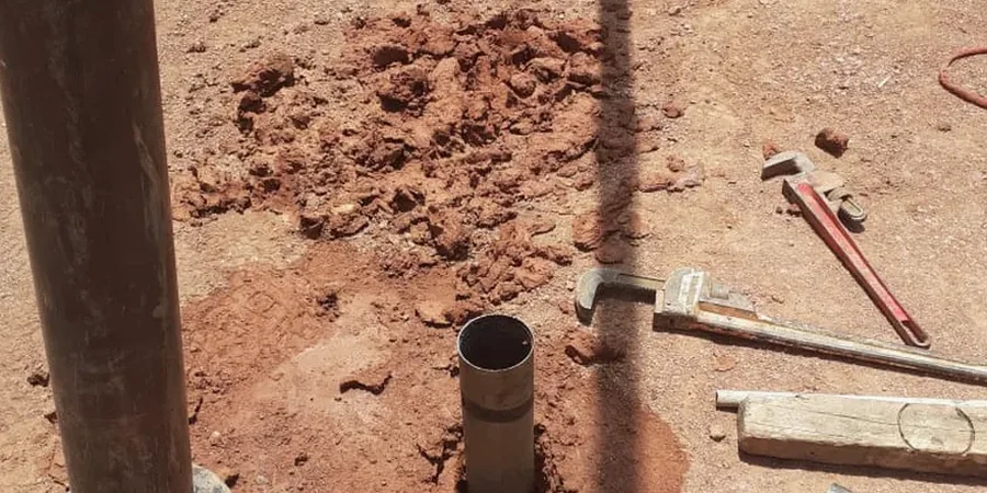
What is the difference between a Lefranc test and a Lugeon test?
The Lefranc test is designed for soil and highly weathered rock. We isolate a short section of borehole below the water table—typically one meter—and apply a constant or falling head to measure hydraulic conductivity (k) in meters per second. The Lugeon test is a packer test for competent fractured rock. We seal off a section of borehole with inflatable packers, inject water at stepped pressures, and measure flow in Lugeon units (1 Lu ≈ 1 liter per meter of test section per minute at 10 bar). Lugeon is the standard for assessing whether grouting is needed; Lefranc is the go-to for dewatering and infiltration design in soils.
How long does a field permeability testing program take in Abbotsford?
A typical program with two to three Lefranc tests in overburden and two Lugeon tests in bedrock takes two to three field days, assuming the boreholes are already drilled and developed. Each Lefranc test requires about 45 to 90 minutes to reach steady-state flow; a full five-stage Lugeon test runs roughly 60 to 90 minutes per interval. We coordinate closely with the drilling crew to minimize standby time. Lab correlation work and final reporting add another five to seven business days. For time-sensitive projects in the Abbotsford industrial area or along the Highway 1 corridor, we can mobilize within 48 hours.
What do field permeability tests cost in Abbotsford?
Field permeability testing programs in Abbotsford typically range from CA$880 to CA$1,630 per test interval, depending on depth, formation type, and whether we use a single or double packer configuration. A complete program with three Lefranc tests and two Lugeon intervals generally falls between CA$4,400 and CA$8,200, including mobilization within the Fraser Valley, digital data acquisition, and the final hydrogeological report with dewatering recommendations.
Do I need a field permeability test or can I just use grain-size correlations?
Grain-size correlations like Hazen or Kozeny-Carman give you an estimate, but in Abbotsford's glacial soils they can be off by an order of magnitude or more. The Sumas Drift contains silt lenses, cobbles, and occasional boulders that lab samples rarely capture representatively. A field test measures the formation's bulk permeability at the scale that matters for dewatering or infiltration design—including secondary porosity from fractures, root channels, and sand seams that a sieve analysis will never detect. For any project requiring a dewatering permit or a groundwater protection plan, the BC Ministry of Environment typically expects field-measured k values, not just lab-derived estimates.